
- ઝી ન્યૂઝ ગુજરાતી
- /આંતરરાષ્ટ્રીય
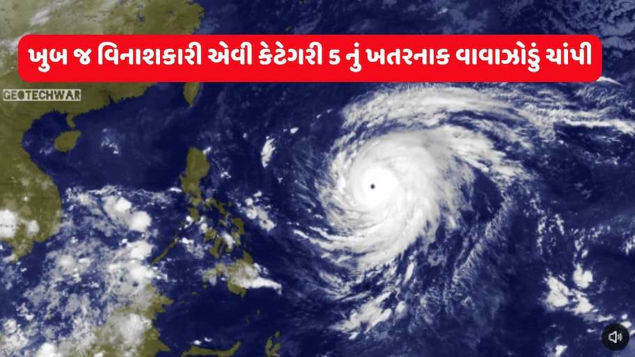
- /અત્યંત શક્તિશાળી અને ખતરનાક છે ચાંપી તોફાન, આંખ પણ દેખાય છે એકદમ સ્પષ્ટ, જાણો કઈ દિશામાં આગળ વધી રહ્યું છે?
અત્યંત શક્તિશાળી અને ખતરનાક છે ચાંપી તોફાન, આંખ પણ દેખાય છે એકદમ સ્પષ્ટ, જાણો કઈ દિશામાં આગળ વધી રહ્યું છે?
Typhoon Champi: એકબાજુ જ્યાં રાજ્યમાં મોન્સૂન ટ્રફ, વેસ્ટર્ન ડિસ્ટર્બન્સ અને સાયકલોનિકના કારણે વરસાદની સંભાવનાઓ વ્યક્ત કરાઈ છે ત્યાં બીજી બાજુ ટાઈફૂન ચાંપી વધુ શક્તિશાળી થયાના અહેવાલો આવી રહ્યા છે. જાણો કોણે સાવધાન રહેવાની જરૂર પડશે.
Written ByViral Raval
Published: Oct 20, 2026, 02:37 PM IST|Updated: Oct 20, 2026, 02:42 PM IST

Viral Raval
આસીસ્ટન્ટ ન્યૂઝ એડિટર તરીકે Z 24 કલાક સાથે કાર્યરત. ગુજરાત, દેશ-વિદેશના સમાચારો, રાજકારણ, સાંપ્રત ઘટનાઓથી લોકોને રૂબરૂ કરાવવા ઉપરાંત ધાર્મિક, સ્વાસ્થ્ય, યુટિલિટી, ટેક્નોલોજી, મનોરંજન, વેપાર જેવા વિષયો તથા ગુજરાતના ઊંડા અને આંતરિયાળ વિસ્તારોના લોકોની સમસ્યાઓને વાચા આપતી સ્ટોરીઓમાં ઊંડો રસ છે. 14 વર્ષ કરતા વધુ સમયનો ડિજિટલ પત્રકારત્વનો અનુભવ છે. બી.કોમ બાદ ગુજરાત વિદ્યાપીઠમાંથી પત્રકારત્વમાં અનુસ્નાતક (M.A)ની પદવી મેળવી છે. અગાઉ દિવ્યભાસ્કર, સંદેશ, સમભાવ, અભિયાન સાથે કામ કર્યું છે. વર્ષ 2017 નવેમ્બરથી ઝી મીડિયા સાથે જોડાયેલા છે.
Read MoreTrending
- News
- Photos
- Videos